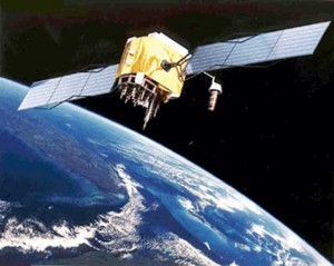
At least 24 of the GPS satellites are needed in orbit to ensure all parts of the planet are covered.
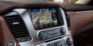
Originally developed for military use, the Global Positioning System has transformed civilian life, as well. It allows us to find friends, restaurants and stores using a myriad of consumer devices, from iPhones to built-in automotive navigation systems.
But the real test of the GPS system is fast approaching. The technology is likely to become essential to the operation of the autonomous vehicles set to start rolling across our highways early in the coming decade. The satellite-based guidance system will be paired up with laser, radar, camera and other sensors that will demand levels of accuracy measured in inches, rather than yards, which is the best the current GPS system can deliver.
A new development by the University of California, Riverside could hold the key to getting there. And their research could payoff in improvements in other consumer products, as well, from mobile phones to wearable technologies.
“To fulfill both the automation and safety needs of driverless cars, some applications need to know not only which lane a car is in, but also where it is in that lane—and need to know it continuously at high rates and high bandwidth for the duration of the trip,” researcher Jay Farrell, professor and chairman of the school’s electrical and computer engineering department, said in a statement.
(Toyota partnership could give connected cars all the bandwidth they need. Click Here for the story.)
The GPS system relies on a network of 24 orbiting satellites, each transmitting a signal that can be picked up by a special receiver. Complex algorithms are used to compare signals from several satellites – typically, three to four must be “visible” at any time – the time difference between each signal helping plot the receiver’s location.
GPS technology, in its rawest form, can provide accuracy of barely 10 yards. An advanced system, known as Differential GPS, or DGPS, also compares signals from a network of fixed, ground-based transmitters, improves the network’s accuracy to about one yard.
The general consensus is that autonomous vehicles will require navigational accuracy of around 10 inches or less, Gill Pratt, the head of the new Toyota Research Institute, recently told TheDetroitBureau.com.
To get there, UCR Prof. Farrell said, requires “GPS carrier phase integer ambiguity resolution.” That’s a fancy way of saying it requires the combination of several different technologies that raise computational demands exponentially. Or, at least, they have.
(Click Here for a complete list of the new product previews scheduled for the 2016 Geneva Motor Show.)
The researchers, writing in IEEE’s Transactions on Control Systems Technology, claim to have come up with a new approach that will not only minimize the demand on processors but, in turn, reduce power consumption and hold down costs.
Having a more accurate GPS signal is only one of the challenges facing researchers developing tomorrow’s autonomous vehicles. The data must then be compared to digital maps far more accurate than those currently used by cellphones or vehicle navigation systems.
That’s spurring a push for high-resolution maps that not only knows where each road is, but how lanes are laid out. One company, Israeli-based Mobileye, wants to map out obstacles as small as potholes. Three-dimensional maps will also be needed so larger vehicles, such as trucks, can be autonomously navigated under bridges and other overhead obstructions.
That was a key reason why Daimler, BMW and Volkswagen’s Audi division last year acquired a unit of Nokia which is working on advanced digital maps that will be at least as accurate as future GPS technology.
(Live from Chicago…Click Here for a round-up of news from this month’s Chicago Auto Show.)
Joe Szczesny contributed to this report.

